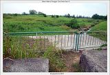
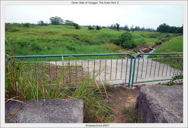
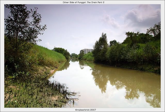
After the last Friday's visit to Punggol, I told myself that I need to explore the Drain. Hence, I revisited Punggol for a second take at Location 12 on Monday 19th March 2007. This time, I was enthusiastic since I had the necessary preparations. I wore jeans and singlet and had my Goretex boots on. I was ready for some terrain bashing! What you see on the left is the overhanging concrete platform, which is also the top of the drain. This marks the end of the drainage pipes running under Punggol estate.
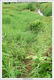
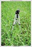
This is the side where the slope is where I have to bash through in order to get to the bottom. Just look at the height of the grass; I have extended my 3-tier tripod to the maximum height. I have to exercise great caution in case I step into a pit that may appear to be concealed under the thick grass.
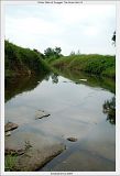
To my surprise, the drain was flooded and the gigantic stones are submerged in the water. That makes moving forward impossible. Dejected, I climbed back up and thought I would visit the other locations in Punggol East. On my way up, I saw a used condom and the foil pack. I thought who would hanky-panky in such open place. They probably did their business on the concrete platform. I took a picture of the condom like a CSI detective, but decided not to post it 'cos I feft that it is sick to do that.
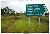
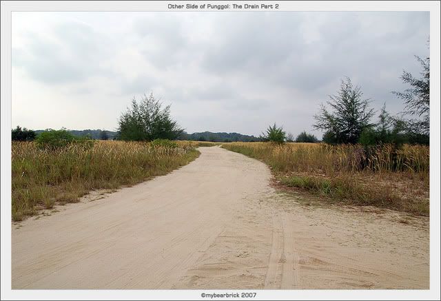
After a few metres away from the drain, I saw this sign which I clearly remembered Alex Otega suggested that this is the one of the route to Location 1, the end of the drain and Serangoon River. There was a distinct clearing among the vegetation and seems like a potential track.


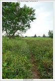
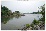
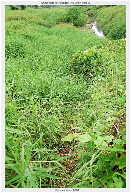
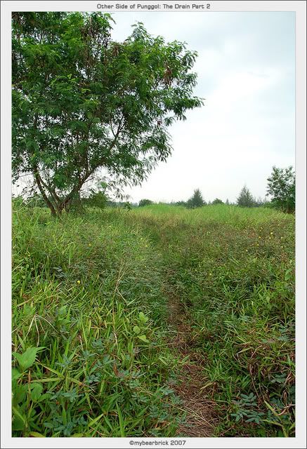
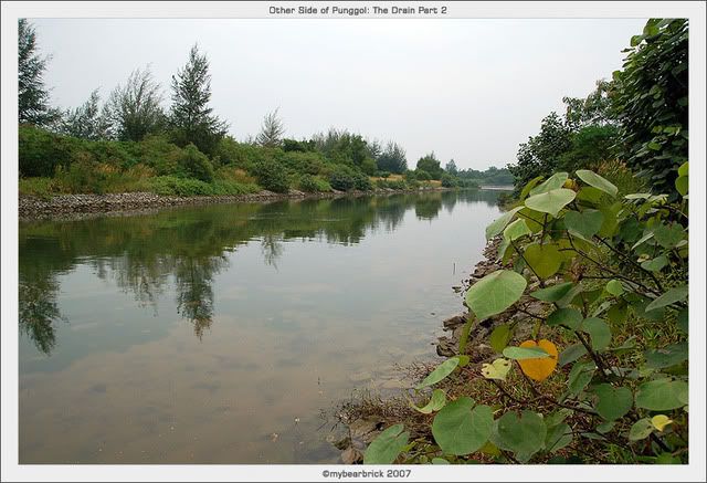
Along the way, there seems like a few diversions. But I decided that I stick to the main track. This whole area is basically a huge 'lalang' field. I took a turn left along one of the tracks and came to the edge of the drain. I was on the eastern bank and the drain appears to be flooded all the way to the open sea.

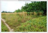
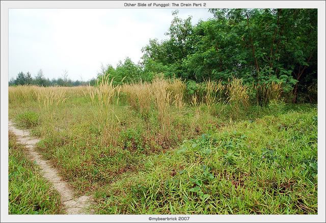
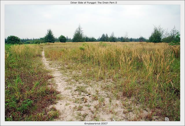
Moving on, I took a few other random peeks over the bank whenever there is a clearing.
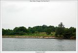
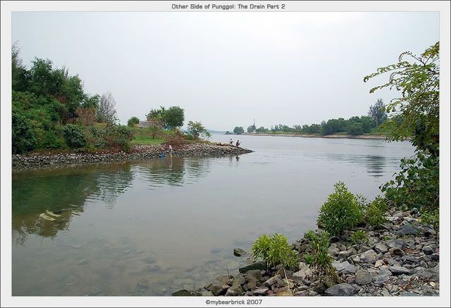
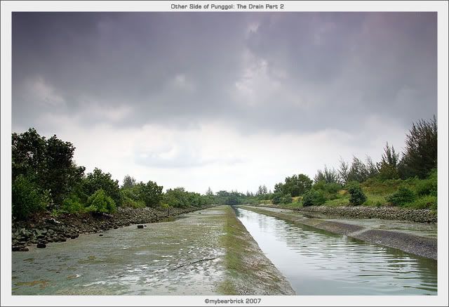
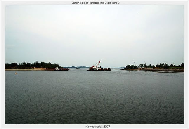
Finally, I was rewarded by all the hardwork. I reach the end of the drain. Being on the eastern bank, I can overlook the western bank and ahead is Coney Island and behind Coney Island is Pulau Ubin or was it Pulau Ubin (which I'm not too sure). The drain was still flooded and on the western bank, there were some people doing line fishing.
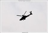
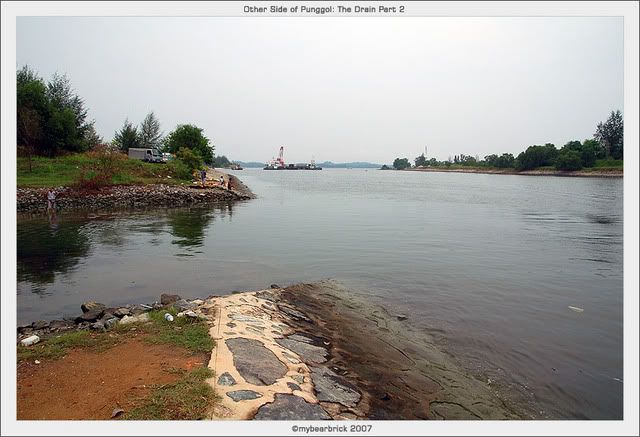
Then it started to drizzle a bit. So I took a break and sat down by the breakwater. I enjoyed the drizzle hitting on my hot skin, while I munch away on a tao sar piah which I had brought along. I took a break and look over to the island opposite and get amazed by the frequent helicopters and planes flying overhead.
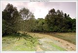
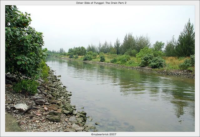
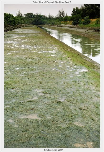
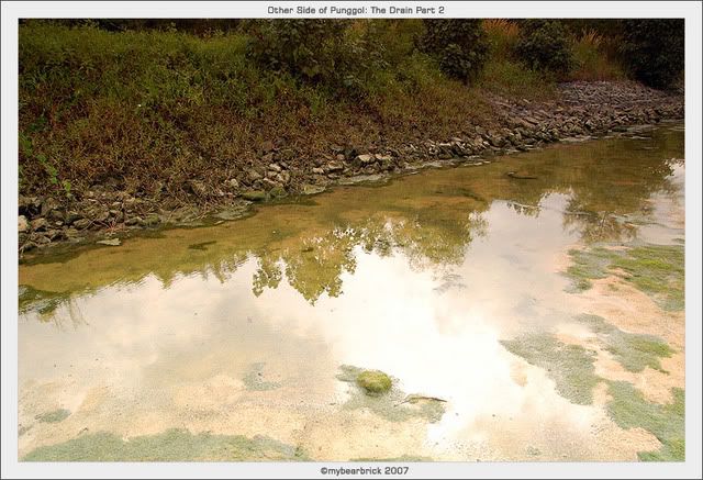
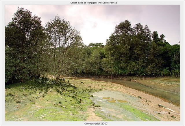
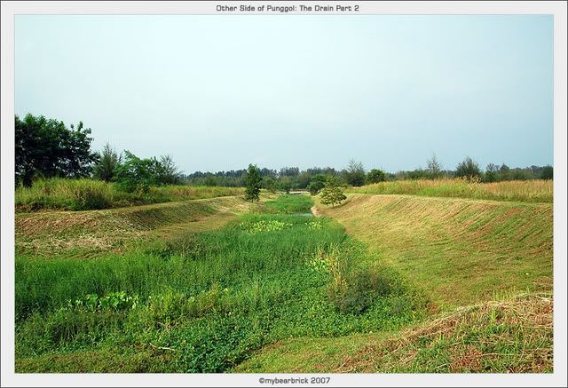
The drizzle stopped at around 3pm. I thought it was about time that I headed back by the way I came. When I walked back to the edge of the bank, I was surprised that the water level in the drain had subsided revealing the drain itself.
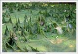
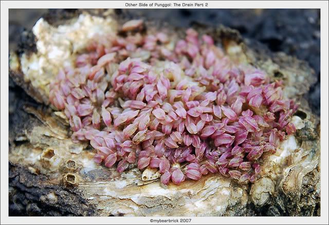
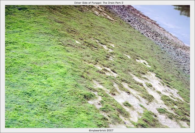
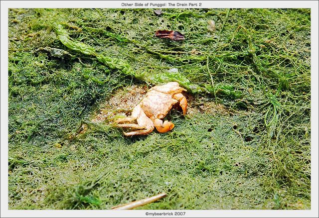
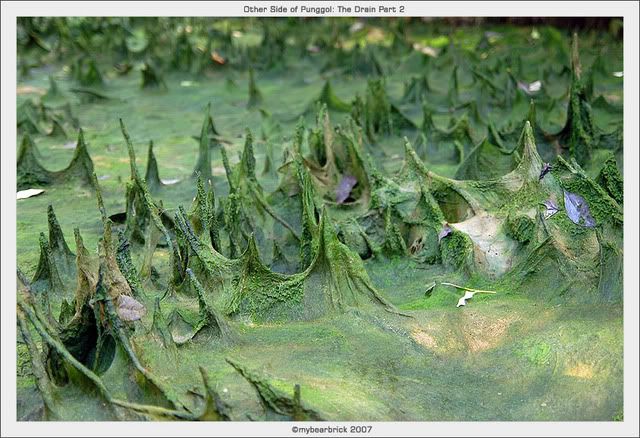
The drain is full of macro marine life and sea weed. Tadpoles and minute fisheds darted in the shallow water that remains on the sides of the drain. Just look at the sea weed coating the ground. Small crustaceans started to creep out from their burrows as well.
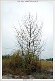
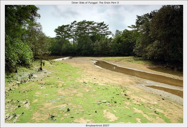
I decided to walk towards Location 12 along the drain. The arial roots of the mangrove tree caught my attention when they were all coated with sea weed. I thought they looked hazardous to step on, but they we rather soft under my boots.
Approaching the bend where the small drain from Location 12 meets the big drain (where I am at), I was surpised to see that the small drain is still flooded and impassable. The reason is that the water was still trickling down into the big drain slowly.
Luckily, a guy came walking towards me and pointed me the right direction. Apparantly, my intuitions were right. The routes that I thought was right, were correct. They will all lead to different parts of Punggol eventually. By the time I was out, it was 5pm. Sadly, I lost my crappy tripod head. Now my tripod is useless since I need the head to mount the camera. It is also pointless that I buy back the same tripod since it is not very good, though its dirt cheap. Anyone got a spare tripod head for me? or get me a Manfrotto tripod (>S$100 wor!) that can be used as a walking stick as well! ;-)
Want to see all the selected pictures in this photoshoot?

This is the side where the slope is where I have to bash through in order to get to the bottom. Just look at the height of the grass; I have extended my 3-tier tripod to the maximum height. I have to exercise great caution in case I step into a pit that may appear to be concealed under the thick grass.
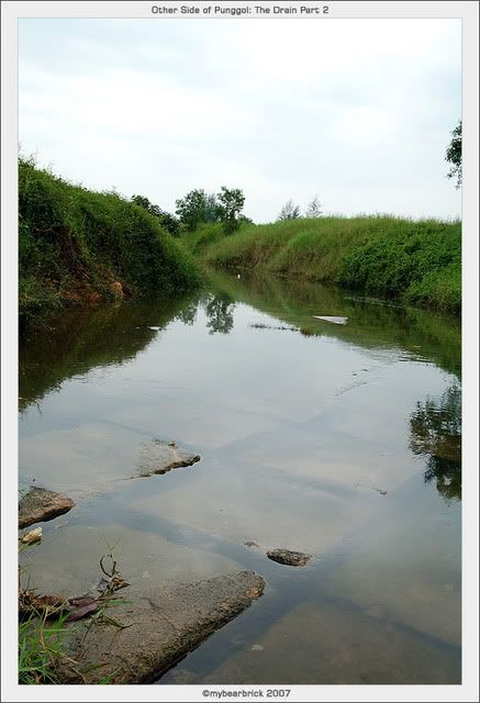
To my surprise, the drain was flooded and the gigantic stones are submerged in the water. That makes moving forward impossible. Dejected, I climbed back up and thought I would visit the other locations in Punggol East. On my way up, I saw a used condom and the foil pack. I thought who would hanky-panky in such open place. They probably did their business on the concrete platform. I took a picture of the condom like a CSI detective, but decided not to post it 'cos I feft that it is sick to do that.
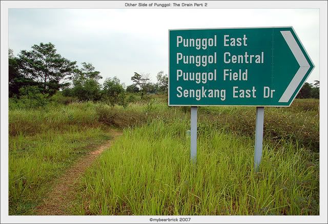
After a few metres away from the drain, I saw this sign which I clearly remembered Alex Otega suggested that this is the one of the route to Location 1, the end of the drain and Serangoon River. There was a distinct clearing among the vegetation and seems like a potential track.

Along the way, there seems like a few diversions. But I decided that I stick to the main track. This whole area is basically a huge 'lalang' field. I took a turn left along one of the tracks and came to the edge of the drain. I was on the eastern bank and the drain appears to be flooded all the way to the open sea.

Moving on, I took a few other random peeks over the bank whenever there is a clearing.
Finally, I was rewarded by all the hardwork. I reach the end of the drain. Being on the eastern bank, I can overlook the western bank and ahead is Coney Island and behind Coney Island is Pulau Ubin or was it Pulau Ubin (which I'm not too sure). The drain was still flooded and on the western bank, there were some people doing line fishing.

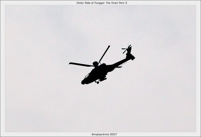
Then it started to drizzle a bit. So I took a break and sat down by the breakwater. I enjoyed the drizzle hitting on my hot skin, while I munch away on a tao sar piah which I had brought along. I took a break and look over to the island opposite and get amazed by the frequent helicopters and planes flying overhead.
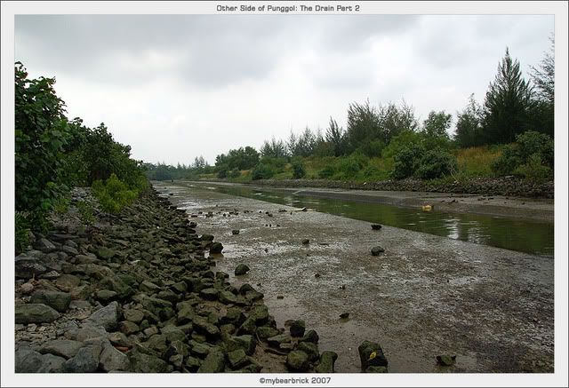
The drizzle stopped at around 3pm. I thought it was about time that I headed back by the way I came. When I walked back to the edge of the bank, I was surprised that the water level in the drain had subsided revealing the drain itself.


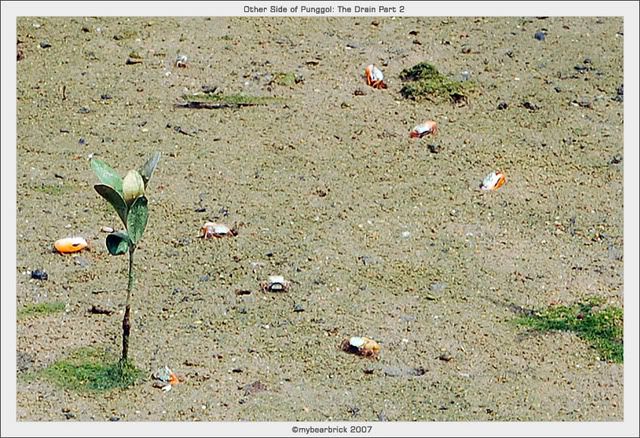
The drain is full of macro marine life and sea weed. Tadpoles and minute fisheds darted in the shallow water that remains on the sides of the drain. Just look at the sea weed coating the ground. Small crustaceans started to creep out from their burrows as well.
I decided to walk towards Location 12 along the drain. The arial roots of the mangrove tree caught my attention when they were all coated with sea weed. I thought they looked hazardous to step on, but they we rather soft under my boots.

Approaching the bend where the small drain from Location 12 meets the big drain (where I am at), I was surpised to see that the small drain is still flooded and impassable. The reason is that the water was still trickling down into the big drain slowly.
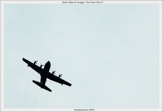
I started realise the frequent planes that fly overhead, which I believe to be training for pilots.
I decided to climb back into the western bank and return by the way the fishing folks came. I remembered that Eikin mentioned about a dirt track that people actually drive in. There was indeed a very distinct track. I followed the route towards the west.
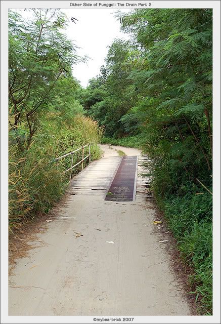
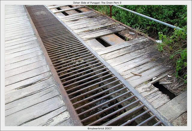
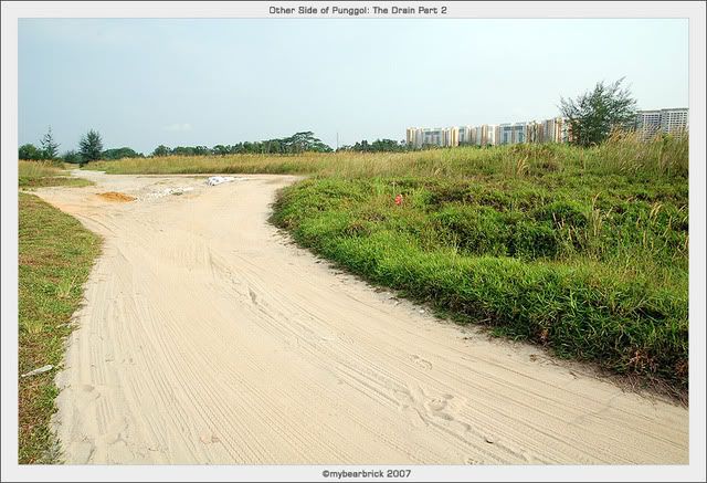
I came to a junction where there were a few diversions. I was not sure which to take, so I took on one which eventaully brought me to the famous metal bridge. After the metal bridge, it seems like a huge open lalang field and the route seemed to lead to deeper instead of out towards the residential estate. I headed to and fro the various diversion which seem like they were nearer but they seem endless. I was lost!

Luckily, a guy came walking towards me and pointed me the right direction. Apparantly, my intuitions were right. The routes that I thought was right, were correct. They will all lead to different parts of Punggol eventually. By the time I was out, it was 5pm. Sadly, I lost my crappy tripod head. Now my tripod is useless since I need the head to mount the camera. It is also pointless that I buy back the same tripod since it is not very good, though its dirt cheap. Anyone got a spare tripod head for me? or get me a Manfrotto tripod (>S$100 wor!) that can be used as a walking stick as well! ;-)
Want to see all the selected pictures in this photoshoot?
technorati tags
Singapore Punggol Photography Nature Serangoon Coney+Island
Comments
Those from 7388 onwards brought back a flood of strong,sweet memories for me. I was doing a lot of angling all over that entire area, weekly, for some years in 90's.
Thanks for the memories! And keep up the good job.